Search This Blog

Showing posts with label Mountains. Show all posts

Wednesday, April 20, 2016

Mueller Park Trail - Bountiful, Utah

Oh mountain biking.
How we have a love hate relationship. I love being outside, fresh air sunshine dirt trails, and a happy dog chasing my bike behind me. But those first few rides of the season can be tough.  Now that I graduated, I don't spend a whole lot of time on my bike (I used to ride it to school), and with winter just wrapping up, I hadn't spent too much time on my bike on the trails. Matter of fact the last time I sat in my bike seat, was Navajo Rocks in Moab.
 Yep, over a month ago. 
It is a great workout and something I enjoy more and more, with the exception of those first few rides that remind me how out of shape I am.  Not even so much on my legs but man does mountain biking set my lungs on fire. If your legs don't feel like blocks of lead, then your lungs will surely feel like they are burning out of your chest after a few hundred feet (especially here where the air is already thin - sea level fo life). 

Thursday, March 10, 2016

Mountain Biking Navajo Rocks - Moab's newest trails!


After having fun on the M&M trail, and confident in our bikes and legs, we decided to spend another day on our bikes.  I did a little bit of research for another trail while sipping amazing coffee from Moab Coffee Roasters when I came across Navajo Rocks. 


Again, I needed beginner/intermediate levels and dog-friendly trails.  The easy part is virtually everything outside of the national parks is dog friendly.  The hard part can be finding the right trail for your skill and comfort level.  

Thursday, January 14, 2016

Eira do Serrado and Curral das Freiras- Madeira

Eira do Serrado (Lookout Point) 
and Curral das Freiras (Nun's Valley)
Mountains of the Interior

After our morning trip up to Pico do Arieiro, we had plans to see some more of middle Madeira, or as my guidebook called it "Mountains of the Interior". A trip to Curral das Freiras (Nun’s Valley) is one of the most popular trips from Funchal (capital of Madeira).  After seeing Madeiras majestic peaks, it only seemed right to drive down into its gorgeous valleys, nestled in between the mountains. Curral das Freiras sits in a huge cauldron, and earned its name as Nun's Valley  in 1566 when the nuns of Santa Clara convent fled from pirates attaching Funchal and found refuge in this area. 


     No Car? No Problem!
Book a tour HERE to see this part of the island, 
along with other spots of central Madeira. 

View down below of Nun's Valley

This trip is that typical Madeiran combination of awe-inspiring mountain scenery, an easy-going walk, local specialties and welcoming locals.  Also in this area, is a very popular Miradouro (viewpoint) called Eira do Serrado.  If you want to combine a nice walk with these two spots, you can drive to the Eira do Serrado lookout (1094 m above sea level) and hike down to Curral das Freiras. The path starts behind the hotel and is 3.3 to 4.5 km, roughly a 1.5 to 2 hour walk (depending which guide you read).  You will have to climb back up to get to your car, or if you are taking a bus or taxi, they can meet you at the bottom (last busses from Curral das Freiras leave leave in the evening, morning busses stop in Eira do Serrado but later services miss it).  
Terraced garden in Curral das Freiras 

Or, you can do it the lazy/short on time way and drive to each destination separately. Which is exactly what we did.  We drove to Curral das Freiras snapped a few pictures and had lunch at Vale das Freiras. This area is known for its scenic views of the valley, but also their local chestnuts (Castanha) and ginja, a cherry liquor.  The local chestnuts are harvested between October and January.  We had some of the famous roasted chestnuts, poncha, and ginja along with other Portuguese specialties of meat, fish and potatoes.  This area is also well known for its Chestnut festival originating back to when the area had a suprlus in chestnuts.  Chestnuts were used (and still are) in anything from soups and cakes, to puddings and liquors.  Vale das Freiras was a great spot to have lunch right off the main road with a balcony, tables, and umbrellas looking over the beautiful views of the valley.

Roasted Chestnuts 
Having lunch in Curral das Freiras


Views in Curral das Freiras 
Eira do Serrado viewpoint 
Start of the walkway at Eira do Serrado
Hike down from Eira do Serrado to Curral das Freiras \
Walkway at Eira do Serrado 
View from Eira do Serrado of Curral das Freiras

Wednesday, January 13, 2016

Madeira Mountains of the Interior - Pico do Arieiro


This post is for my Mountain Loving Utah Friends.  
Well, its for you too, but when I saw this peaks towering over the island, it really reminded me of Utah (you know, minus the whole Atlantic Ocean thing).  While traveling around this beautiful island, you will be amazed at how mountainous and steep the geography is.  But you will not expect to drive up the mountain and find these jagged peaks poking through the clouds, towering high about the Atlantic Ocean. 

Dreamy, isn't it?

Courtesy of Google Maps 
From Funchal:  ~ 40 minutes 

No Car? No Problem!
Book a tour HERE to see this part of the island, 
along with other spots of central Madeira, including hotel pickup.

You can drive up to this peak (Pico do Arieiro, the third highest peak at 1,818 meters, 5,965 feet) where you will find a cafe, the Portuguese air force radar station, and amazing views of Madeira's peaks.  There is just something so beautiful about seeing the peaks poking through the clouds, with the Atlantic Ocean exposed in the background.  It combines my new love of mountains with my old and existing love affair with the water.  You really can have it all on Madeira Island. 

This is also a popular spot to start a hike or catch a sunrise (and you will not be alone!).  If you have the time and the will power to hike Madeiras mountain peaks, this is where you will start.  You can drive up and hike from this spot, Pico do Arieiro (the third highest peak on the mountains) and hike over to Pico Ruivo (the highest peak at 1862 meters, 6,108 feet).  While I didn't have time to complete this hike, I heard it is a stunning view of the island and probably one of the best hikes on the island.  But it is not for the faint of heart as you teeter on cliff edges and make your way through dark tunnels.  There is also a daily average of around 1,000 tourists on this path in the peak seasons so if crowds aren't for you, think twice about this hike. 

I also recommend going with a guide (I did for my levada walk) as not only do they solve the transportation problem, but you have insurance through the guide group, and an amazing commentary about the native plants, animals and landscape on the island (for a great price! ~32-36 euros, about $38).  

Entrance to Pico do Arieiro
If hiking Madeira's peaks isn't your cup of tea, then do not worry, you can just drive right on up to Pico do Ariero to snap a few pictures and take in the beautiful views. The drive is steep, but worth the climb to be above the clouds. This volcanic island is a pretty amazing feat, when you see these tall peaks jutting up from this relatively small island sitting in the Atlantic Ocean.  This is a must see spot if you are lucky enough to visit the beautiful island of Madeira. 

Roadway below the viewing area
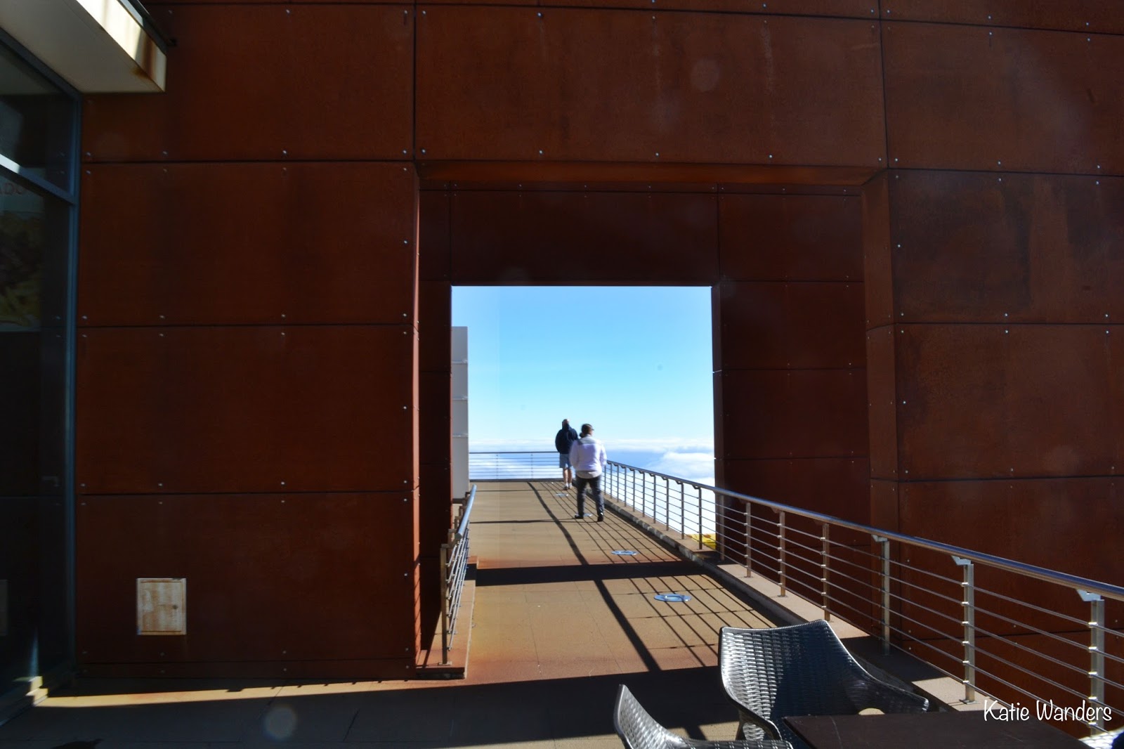
My family at the lookout balcony
Family above the clouds 
Deck at the gift shop
Mountain peaks, Madeira Island 
Trail signs, alternate route to Pico Ruivo 
Hiking trail to Pico Ruvio

Katie Wanders among the mountain peaks!
Clouds rolling into Madeira Island
Viewing balcony

Thursday, June 25, 2015

Hike to Blood Lake and Lackawaxen Lake - Guardsman Pass, Utah


Post Update 9/14/2015   *  This trail is now closed. 

"Bloods Lake Trail is located on private property in Wasatch County, near Park City, UT. Any entry onto or use of the property without prior written consent of the Owner constitutes trespass and the Owner may pursue all available legal remedies to enforce it".


Today we are talking about Lake Lackasomething Lackawaxen Lake.  Its a peculiar name in a gorgeous area.   According to Road Trip Ryan  "Lackawaxen Lake is the pretty lake, with an odd name. It, presumably, is named after the Lackawaxen River (or Township) in Pennsylvania". 
How that correlates to Utah?  No clue.